Summary
DCG announces official integration of Tersus GNSS receivers with ArcGIS Field Maps on Android—enabling centimeter-level positioning, full correction protocol support (NTRIP, RTK with UHF Radio, Satellite-based real-time corrections), and datum-aware configurations to mitigate transformation and elevation discrepancies in the field.
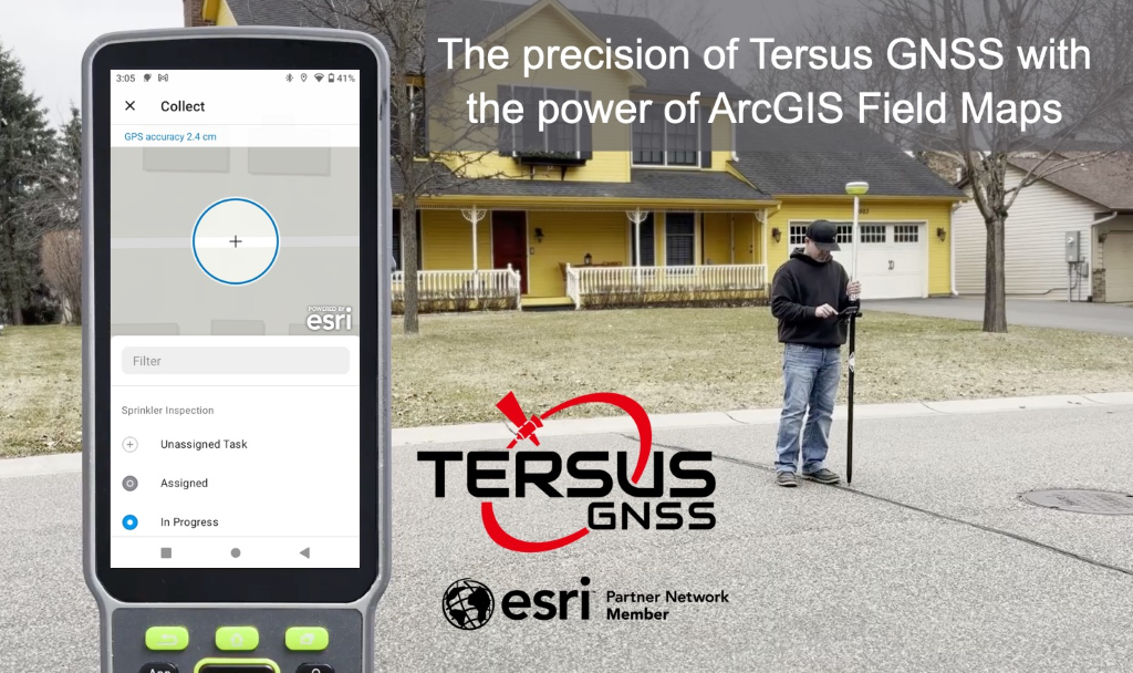
Desert Creative Group (DCG) is excited to announce official support for Tersus GNSS receivers with ArcGIS Field Maps, Survey123, and QuickCapture on Android. As a proud Esri business partner, we’re committed to helping organizations achieve the highest field accuracy while maintaining flexibility in their geospatial workflows. For those seeking technical reliability and spatial accuracy in the field, this integration delivers on all fronts:

- Centimeter-Level Accuracy: Only the best for your field crews!
- Empower your survey and GIS teams: One reliable, high-performance receiver for all.
- Full Correction Support: NTRIP, RTK with UHF Radio, Satellite-based real-time corrections (we’ve got you covered!).
- Datum-Aware Configurations: Avoid costly alignment or elevation errors.
- Pair with Tersus Nuwa software for maximum productivity.
- Future-Proof Your Strategy: DCG helps you align GIS + Field work, seamlessly.
ArcGIS Field Maps June 2025 Release
Highlights from the June 2025 ArcGIS Field Maps release include:
- Map Templates – Your existing maps can now become map templates for faster deployment to the field.
- Task Coordination – DCG has also been beta testing the new Task management capability in ArcGIS Field Maps, and it will transform how organizations assign, track, and complete field work. It’s designed to boost operational efficiency and provides a centralized and spatially aware tasking system directly within the Field Maps app.
Click Here to see the complete Esri article about What’s new in ArcGIS Field Maps (June 2025).
Benefits of Using Tersus Nuwa Software
In addition to Field Maps compatibility, Tersus Nuwa software offers a robust and intuitive platform for field data collection. Designed with the needs of surveyors, engineers, drone pilots, and GIS professionals in mind, Nuwa integrates advanced functionality with user-friendly workflows—making it an ideal companion to ArcGIS Field Maps in precision-driven environments.

Nuwa software comes with with every Tersus smart GNSS receiver purchase. Use it with a Tersus TC40 or TC80 Controller or your own Android device with no annual fees. See for yourself – free download.
Nuwa software features include:
- Advanced cogo functions
- Alignments with station and offset
- Surface creation and staking
- Stake to DXF support
- AR/Graphical staking
- Grid to Ground support
- Configure GNSS Base Receivers and Log Static Data
- Work with local sites through calibrations
- Visual Positioning – extract data from photos and create point clouds — real-time in the field!
DCG Will Help Align Your Positioning Strategy
Our experienced personnel understand the complexity of geospatial fieldwork. We provide hands-on support for:
- GIS + GNSS workflows and strategy
- Transformations and elevation alignment
- Field hardware setup and best practices
- Base stations and real-time corrections
Ready to elevate your field workflows? Contact us today to schedule a consultation or product demonstration.